Drone mapping is being used in wide range of applications, major ones are listed below-
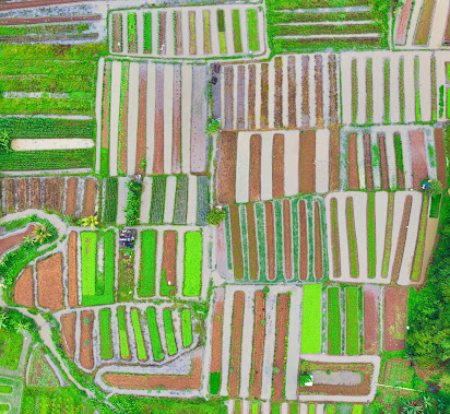
- Agriculture: Drone mapping is widely used in agriculture for crop monitoring, yield estimation, and irrigation management. It provides farmers with detailed information about their crops, such as plant health, water stress and growth patterns, allowing them to make informed decisions about their farming practices.
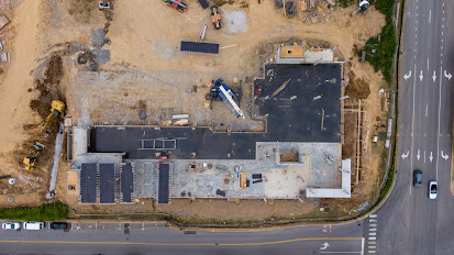
- Construction Planning and Monitoring: Drones can monitor construction sites, inspect infrastructure such as bridges and buildings and assess the progress of construction projects. They can capture images, videos and thermal data to identify potential issues, measure stockpile volumes and ensure compliance with safety regulations. Drone mapping is useful in the construction industry for site planning, progress monitoring and safety inspections. It provides contractors with accurate information about the construction site including topography, terrain and obstacles, enabling them to plan their construction activities in better way.
- Mining: Drone mapping is used in the mining industry for mineral exploration, stockpile management, and safety inspections. It provides miners with detailed information about the mine site, including the location of minerals, the volume of stockpiles and the condition of equipment, allowing them to optimize their mining operations.
- Land Surveys: Drone mapping is used in surveying for land mapping, topographic mapping and boundary mapping. It provides surveyors with accurate information about the terrain and features of the land, enabling them to create precise maps and models.
- Environmental Conservation: Drone mapping is used in environmental conservation for wildlife monitoring, habitat mapping and environmental assessments. It provides conservationists with detailed information about the ecosystem including the location of wildlife, the condition of vegetation and the extent of environmental damage, allowing them to make informed decisions about conservation efforts.
- Archaeology and Cultural Heritage: Drones enable archaeologists to survey and document archaeological sites from the air, providing a broader perspective and aiding in site preservation. Aerial mapping helps identify buried structures, map ancient landscapes, and create 3D models of cultural heritage sites.
- Search and Rescue Operations: Drones equipped with thermal imaging cameras and GPS can aid in search and rescue operations. They can cover large areas quickly, locate missing persons, and provide real-time situational awareness to rescue teams, saving time and resources.
- Disaster Response and Damage Assessment: After natural disasters, drones can be deployed to assess the extent of damage to infrastructure, map affected areas, and aid in disaster response planning. This information helps prioritize relief efforts and facilitates efficient resource allocation.


